In an effort to assist small-scale food producers in Hawai‘i select vegetable varieties best suited for their specific locations, the Hawai‘i Public Seed Initiative (HPSI) is pleased to offer the Hawai‘i Seed Variety Selection Tool. This tool consists of two parts:A map that defines climate zones for Hawai‘i, andA database that identifies varieties of vegetable crops that farmers and gardeners contributing to this tool have found to be successful in these zones.

The Hawai‘i Seed Variety Selection Tool was developed through a mini-grant administered by HPSI and funded by the Ceres Trust. It combines data including elevation (as a proxy for temperature) and moisture availability to define 18 climate zones found throughout the Hawaiian Islands. Elevation data were obtained from the Hawai‘i Office of Planning’s Statewide GIS Program. Moisture availability is based on the “Moisture Zones” developed by Dr. Jonathan Price from the University of Hawai‘i at Hilo (see References). Moisture Zones incorporate both precipitation and evapotranspiration due to surrounding vegetation.
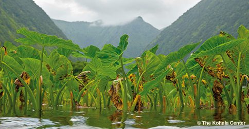
Experienced farmers and gardeners throughout the state contribute to the database through a voluntary survey conducted by HPSI. Participants are asked which varieties of seven different crops (Lettuce, Tomato, Eggplant, Squash/Pumpkin, Peppers, Beans, and Taro) perform best at their specific growing locations. Participants also provide qualitative data indicating what they like about each variety (drought resistance, disease resistance, yield, flavor, etc.) and in which season(s) it performs best at their locations.
Source: Seed Variety Selection Tool for the Hawaiian Islands – The Kohala Center